 FAO Map Catalog
base map
Type of resources
Available actions
Topics
Keywords
Contact for the resource
Provided by
Years
Representation types
Update frequencies
status
Scale
-
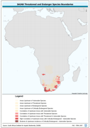
Threatened to endangered species watershed boundaries based SAIAB and HYDRO1k. Source: SAIAB and HYDRO1k, "river" flow, and watershed networks based on the GTopo30. The AQSP_THRTND_PY shapefile data layer is comprised of 92 derivative polygon aquatic species features derived based on 1:2 000 000 data originally from SAIAB. The layer provides nominal analytical/mapping at 1:2 000 000. Acronyms and Abbreviations: SAIAB - South African Institute for Aquatic Biodiversity; HYDRO1k - Global Hydrological 1 kilometre database of hydrologically filled DEMs; DEM - Digital Elevation Model; GT30/GTopo30 - Global Topographic 30 arc second DEM database, nominal 1km postings.
-
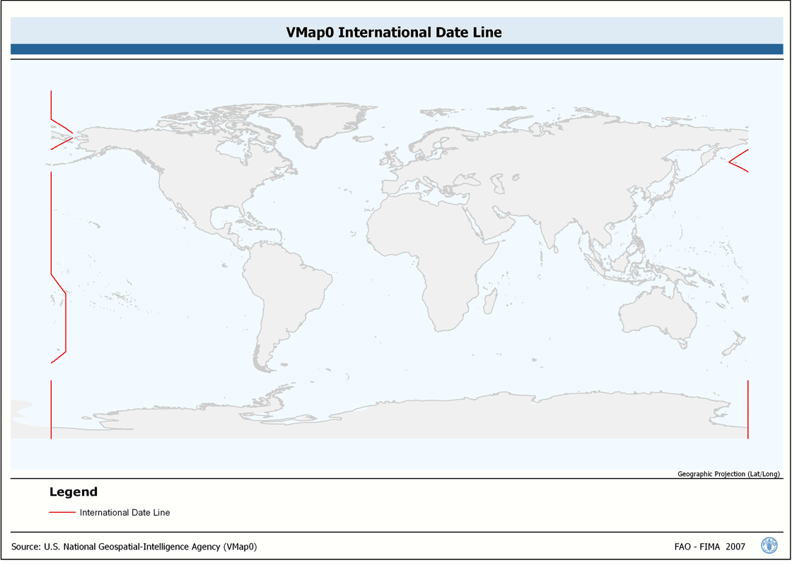
Seamless and topologically robust derivative of linear VMap0 - Ed5 Industry and related data layers. The INTDT_LN shapefile data layer is comprised of 82 derivative vector framework library features derived based on 1:1 000 000 data originally from VMap0, 5th Edition. The layer provides nominal analytical/mapping at 1:1 000 000. Data processing complete globally, this is an African subset. Acronyms and Abbreviations: VMap0 - Vector Map for Level 0.
-
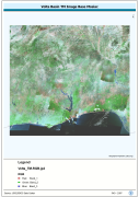
Enhanced natural color orthorectified image baseline, reprojected and mosiaced into single coverage of a Megabasin. Source: NASA Landsat Orthorectified MSS, TM and ETM+. The VOLTA_TM-RGB image data layer is comprised of 42465x46324 derivative image satellite based imagery features derived based on 28.5 metre data originally from TM.
-
Catalog of Arc-Grid based derivaitive of SRTM 3-arc second Version 2 DEM for Africa, seamless baseline of 3 204 1x1 overlapping tiles. SRTM is Shuttle Radar Topography Mission; DEM is Digital Elevation Model. The SRTM-3AS_IMGCAT_BASE Image data layer is comprised of 3204 derivative calculated seamless image catalog features derived based on 0.000833_ data originally from FAO.
-
Seamless and topologically robust derivative of VMap0 - Ed5 data layers. The ED5LR_LN shapefile data layer is comprised of 5978 derivative vector framework library features derived based on 1:1 000 000 data originally from VMap0, 5th Edition. The layer provides nominal analytical/mapping at 1:1 000 000. Data processing complete globally, this is an African subset. Acronyms and Abbreviations: VMap0 - Vector Map for Level 0.
-
Seamless and topologically robust derivative of source VMap0 data layers for landmass and oceanic island data layers. The MASK_PY shapefile data layer is comprised of 2 derivative vector framework library features derived based on 1:1 000 000 data originally from VMap0, 5th Edition. The layer provides nominal analytical/mapping at 1:1 000 000. Data processing complete globally, this is an African subset. Acronyms and Abbreviations: VMap0 - Vector Map for Level 0.
-
Seamless polygonal continental landmass and oceanic island mask data layer derived from SRTM-SWBD tiled database. The MASK_PY shapefile data layer is comprised of 4333 derivative vector surface water bodies features derived based on 1:100 000 data originally from SRTM-SWBD. The layer provides nominal analytical/mapping at 1:125 000. Data processing 60% complete globally, with African and Arabian subsets 100% complete. Acronyms and Abbreviations: SRTM - Shuttle Radar Topography Mission; SWBD - Surface water Body.
-
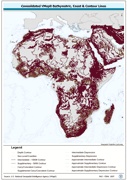
Seamless and topologically robust derivative of all linear VMap0 - Ed3 bathymetric, coastline, and terrain contour data layers. The HYPSO_LN shapefile data layer is comprised of 108715 derivative vector framework library features derived based on 1:1 000 000 data originally from VMap0 | 5th Edition. The layer provides nominal analytical/mapping at 1:1 000 000. Data processing 75% complete globally, with African subset 100% complete. Acronyms and Abbreviations: VMap0 - Vector Map for Level 0.
-
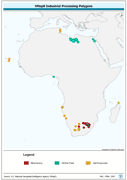
Seamless and topologically robust derivative of VMap0 - Ed5 data layers. The INDUS_PY shapefile data layer is comprised of 92 derivative vector framework library features derived based on 1:1 000 000 data originally from VMap0, 5th Edition. The layer provides nominal analytical/mapping at 1:1 000 000. Data processing complete globally, this is an African subset. Acronyms and Abbreviations: VMap0 - Vector Map for Level 0.
-
Seamless and topologically robust derivative of VMap0 - Ed5 data layers. The PPL_PY shapefile data layer is comprised of 1505 derivative vector framework library features derived based on 1:1 000 000 data originally from VMap0, 5th Edition. The layer provides nominal analytical/mapping at 1:1 000 000. Data processing complete globally, this is an African subset. Acronyms and Abbreviations: VMap0 - Vector Map for Level 0.